A Game Changer: Hawai’i County Launches Multi-Modal Transportation Plan, Brings Big Changes to the Big Island’s Mass Transit System
Imagine this: You live in Hilo and are driving to Kailua-Kona everyday for your job at a South Kohala Resort. Or perhaps you live in Ocean View, but you make the drive to Hilo a few times a week for classes at the University of Hawai?i at Hilo.
Whether you’re just trying to make a living or you’re hoping to further your education, commutes like these can be a drain. They’re physically exhausting, costly when it comes to filling up the gas tank, a source of carbon emissions… and part of life on Hawai’i Island.
If interim Mass Transit Administrator at Hawai’i County, John Andoh, has anything to say about it however, this inefficient, unconnected way of life could become a distant memory.

Big changes are not only on the horizon for the Hawai’i County Mass Transit System, but are already underway. Today, we’ll look at how Mr. Andoh is leading the agency to implement the county’s Multimodal Transportation Plan, history and highlights of the plan, integration of the hub-and-spoke model and the HIBIKE Bikeshare system, increased Hele-On service, and more!
Let’s get started!
Mr. Andoh Leads Implementation of the County’s Multimodal Transportation Plan
When John Andoh began his position as Hawai’i County’s interim Mass Transit Administrator a couple of months ago, he immediately dove head first into advancing the county’s multimodal transportation plan. With decades of experience in mass transit management, Mr. Andoh got his start in mass transit right after graduating from high school in California. And he’s still working in public transit 21 years later.
Mr. Andoh’s experience includes managing rural, small urban, and large urban transit systems throughout the U.S., with an emphasis on working with transit systems in need of rejuvenation or implementation of new program services, as well as restructuring systems for operational efficiencies.
Previously, Mr. Andoh held the position of Executive Director of the Central Midlands Regional Transit Authority (the COMET) in Columbia, SC for three years. There he led innovations, including transforming the public transit agency into a mobility manager.
“I implemented multiple services such as van pools, bike sharing, flexible demand responsive services, and a lot of technical advances,” explains Mr. Andoh, whose work has taken him from California to Oregon and South Carolina, and landed him here in Hawai’i earlier this year.
“Mayor Mitch Roth brought me to Hawai’i County to implement the actions detailed in the transit and multimodal transportation master plan adopted in 2018,” says Mr. Andoh of his big move to the Big Island. “Additionally, I came onboard to restructure Hele-On to be a true economic driver for this island, and bring in new modes to help move people around.”
These modes include the department’s partnership with People for Active Transportation Hawai’i (PATH) to put into action HIBIKE, van pools, partnerships with Lyft and Uber, and a new route network that will make it easy for everyone to get around the island.
Mass Transit Fun Fact: Also known as demand-responsive transport, demand-responsive services, or flexible transport services, flexible demand responsive services are a form of shared private or semi-public transport for groups traveling where vehicles generally pick up and drop off passengers in locations based on the passengers’ needs. This can include buses, taxis, or other vehicles.
Big Changes to the Big Island’s Mass Transit System
“Many people have this idea that transit systems which include affordable mass transit and micro mobility options are just for cities,” says PATH’s executive director, Jessica Thompson. “It’s common to think that only those who live in New York City, L.A., or another metropolis can use transit as a way to get around without a car or single occupancy vehicle.”
Fortunately, John Andoh’s work is quickly proving that transit systems are for communities of all shapes and sizes. And rural areas such as communities on Hawai’i Island are hardly an exception.
That’s not to say that improving transit systems in large areas that are regarded as more rural doesn’t come with its challenges, as Mr. Andoh experienced first hand in Columbia, SC. There, his department served not one but two counties, Richland and Lexington Counties.
“Columbia is a large urban area but the surrounding areas are highly rural. Their transit needs were just as important as an urban area,” says Mr. Andoh, revealing that he learned how to meet those needs while working in Columbia. “In the case of the 4200-square mile island of Hawai’i, there is a need for people who work on one side to get efficiently and safely across to the other side of the island. Meeting that need is of paramount concern!”
Mr. Andoh is also focusing on addressing the need for internal circulation within urbanized areas of rural environments, such as Hilo, Kailua-Kona, Waimea, and Pahoa. Multimodal opportunities in these areas would offer individuals the transportation necessary for accessing jobs, educational opportunities, healthcare, pharmacy, and recreation.
“It can start simple, like with a bikeshare system in rural areas for “first mile, last mile” connections from a transit bus to someone’s destination,” affirms Mr. Andoh, pointing out that bikesharing can also be combined with flexible demand responsive services like a taxi, or transportation networks like Lyft and Uber.
Even volunteer transportation is a perfect example of how to help those in areas where a traditional mainline bus service just isn’t possible. It’s an option that would recruit volunteer drivers who would be reimbursed on a mileage rate.
History of the County’s Multimodal Transportation Plan
In 1992, Hawai’i County studied the Hele-On Transit System, which was fairly rural at the time. With an emphasis on connecting people to their jobs or housing in Hilo to jobs in West Hawai’i, the system primarily operated Monday through Saturday and had limited internal circulation within Kailua-Kona and Hilo (with a few routes that connected transit users to Pahoa, Ocean View, and Volcano).
Since 1992, Hawai’i County has grown exponentially, primarily in the Puna district, Kailua-Kona, and in the suburban areas that are connecting those communities. The transit system, on the other hand, has not caught up.
The lack of growth coupled with inability to deliver reliable services to the island prompted the County Council to restudy the transit system and set the framework for successfully providing public transportation island-wide for the next 20 years.
Highlights of Hawaii’s Mass Transit Plan
The hub-and-spoke model and so much more!
From 2015 to 2018, a consultant team was engaged to study Hawai’i Island transportation patterns, reviewing the island’s various communities and making transit system recommendations.
In August of 2018, a transit and multimodal transportation master plan was adopted. Included in the master plan’s key elements and principal goals is the initiative to redesign the entire transit network, transforming it into a hub-and-spoke system.
Mass Transit Fun Fact: Hub-and-spoke describes a fixed-route transit system designed to offer routes (the spokes) that all join at a central point (the hub). Hub-and-spoke riders travel through the hub to reach different points on the various spokes.
In denser areas like Honolulu on Oahu, feeder routes go into hubs and connect people to intercommunity routes, linking them to other hubs and ultimately to their destination.
The multimodal component of Mass Transit’s master plan includes a paratransit service, which provides transportation for persons with disabilities who cannot take traditional Hele-On bus services. Other multimodal components include enhancements to our shared-ride taxi program, which would include partnerships with Lyft and Uber. A shared-ride program would also benefit communities where transportation options may be limited, enabling people to get around the urbanized areas of Hawai’i Island.
To further promote demand-responsive specialized programs, a partnership with the Hawai’i County Economic Opportunities Council and the Brantley Center (a non-profit serving Hawai’i Island residents with disabilities) would provide door-to-door services for anyone needing to travel for shopping, education, recreation, and medical appointments. These services would be available in areas where there is generally no Hele-On bus service whatsoever.
Another partnership between Mass Transit and PATH aims to provide bikesharing opportunities, offering riders a connection from the transit system to other destinations in the area. It’s an excellent transportation option for the first or last mile of a transit system rider’s commute!
“We have multiple stations that we are funding in partnership with PATH to demonstrate intermodal connection,” Mr. Andoh states. “We’re also launching an opportunity for Hele-On passengers to ride HIBIKEs at no additional cost. All they have to do is get a code from a bus operator!”
A Department of Education (DOE) partnership is in place for anyone in need of school bus transportation. The Department provides bus service in neighborhoods around the island, ensuring access to educational opportunities for Hawaii’s students. To get a bus pass for accessing Hele-On services to a school nearby, passengers can apply with the DOE through the Student Transportation Office.
Here’s Some Info on Getting a Bus Pass Through DOE: Riding the Bus
In 2022, a van pool program will be launched as an extension of the Mass Transit system, enabling commuters to form van pools subsidized by Hawai’i County. Since passengers will be able to travel to employment sites on the island at their discretion, their van pool group may have parking, set the schedule, set their fares, and essentially run their own mini transit service to connect people.
“We’re going to continue to study carsharing services and other multimodal options so that we can offer true mobility opportunities for people who need to get around the island,” Mr. Andoh attests. “Ultimately, the end goal is to reduce traffic congestion and drive economic opportunities for our island.”
Improved Hele-On Services
“This multimodal transportation plan might look different from what many people have in their mind when they think of mass transit systems, like what Hele-On was 20 years ago,” says PATH’s Jessica Thompson. “This improved system is much more than the traditional bus moving people back and forth!”
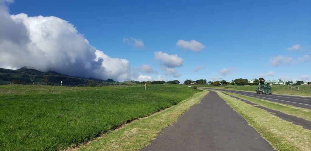
Some of the differences? For starters, a later bus service schedule, services on Sundays and holidays, and frequent routes that run on consistent headways. Additionally, the number of routes and trips has been increased, east-west connections and airport trips added, and the transfer process simplified.
The fleet replacement plan has also been completed and the process of purchasing brand new buses to replace the entire Hele-On fleet is underway. Over the next two to three years, grants will make it possible to get a total of 37 new buses!
Long term, fleet replacement will include transitioning from vehicles that run on diesel and fossil fuels to vehicles that are zero-emissions, running on electricity, battery, and / or hydrogen. The first goal is to replace the entire fleet by 2025 with a reliable fleet to deliver all the services outlined in the master plan.
Phase 2 will bring alternatives to the traditional bus to subdivisions such as Hawaiian Paradise Park, Hawaiian Acres, Orchidland Estates, Ocean View, and along the Hamakua Coast. Either micro transit or small vehicles will run in these areas, connecting people from mainline Hele-On routes to their actual neighborhoods.
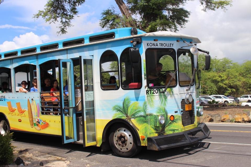
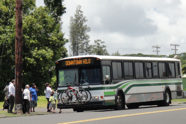
“In the past three months, we’ve launched the first phase of the master plan and restructured all the routes island-wide,” Mr. Andoh elaborates. “We’ve also added new routes, including a route that connects Hilo to Kailua-Kona via the Daniel K. Inouye Highway (Saddle Road), new routes in downtown Hilo, more routes to the Kona International Airport, redesigned routes in the Kailua-Kona area to make trips seamless, and integrated the Kona Trolley into the Hele-On system.”
More new routes are scheduled for February, including a route enabling riders in Na’alehu, Ocean View, and Pahala to go to Hilo and return via mass transit the same day. Another route will create a loop offering riders the option of circling the entire island, which could be popular with tourists.
Also being planned are bus stop improvements, more bus shelters, and the full construction of bus hubs, where routes will connect in off-road locations.
“We also want to foster transit-oriented development, which will spur additional density in those areas where we have hubs. At these hubs could be community centers featuring buildings with restrooms, maybe a community room for meetings or higher educational opportunities, and customer service for getting transit information and bus passes,” says Mr. Andoh, adding that an environmental assessment is in the works for a Pahoa bus hub that could even include a public library.
What’s more, the countywide Hele-On bus system could become free of charge, according to a statement John Andoh made to the County Council earlier this month. Since federal funding is based on total ridership, the two-year, fare-free pilot program might actually bring more money into the county than charging for the service.
With ridership at approximately 300,000 passengers per year, Hawai’i County’s bus system collects only $560,000 annually in bus fares. That’s 1% of annual revenues. On the other hand, a $700 annual bus fare bill significantly impacts low-income passengers who depend on the bus.
“When you’re on a large, rural island, there is a great need to personalize these transportation modes,” adds Jessica Thompson. “And the mass transit team is going to be an innovator in that regard.”
Convenient Options for Payment & Route Planning

From a growing number of transit centers that accept credit cards and a mobile ticketing app, to an updated website that includes maps plotting suggested routes, Hawai’i County Mass Transit has made substantial gains in technology in the six months since John Andoh took over the position of interim Administrator.
“We now accept credit cards at Mo’oheau Bus Terminal and our main office for people who want to buy monthly passes, as well as 10-ride ticket books, paratransit tickets, and rideshare taxis,” says Mr. Andoh, adding that a recent soft launch of a service called Token Transit allows passengers to buy their bus fare on an app. “You can use a credit card or even a cash wallet.”
Soon, Mass Transit riders should be able to use an app to plan their trip, in addition to seeing how many bikes are at a HIBIKE bikeshare station, paying their transit fares, and ordering a Lyft or Uber ride.
“You will also be able to plan your trip using the Google Transit Trip Planner,” Mr. Andoh continues. “And even compare transit times on a Hele-On bus to the time it would take to walk, bike, or drive.”
On routes 2o2 and 204 in Kailua-Kona, a hydrogen pilot project is also being actualized. Anticipated to arrive in January of 2022, the first hydrogen bus will present a fantastic opportunity to test zero-emissions transit.
In the meantime in Hilo, there is an electric bus from automotive and energy storage company Proterra currently running and another demonstration bus that runs on electricity.
Rebranding for Consistency
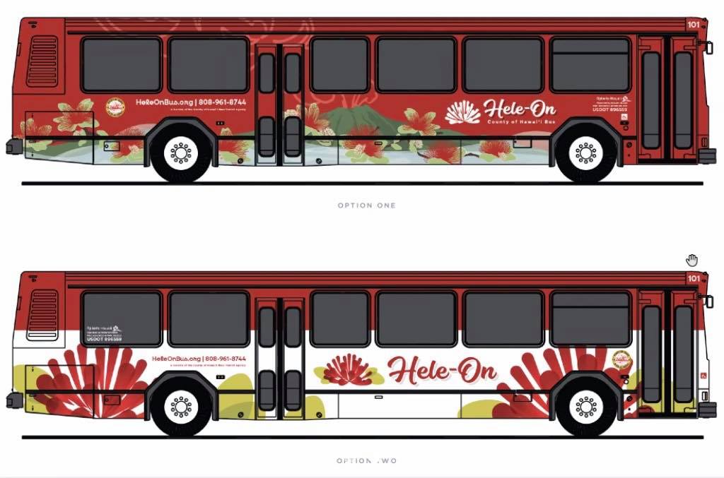
This is just the beginning! John Andoh and Mass Transit are working to add covered benches at bus stops and replace old signage with new signs to display bus route numbers.
It’s all part of a rebranding initiative that includes a new logo, designed around a red ‘?hi’a lehua flower.
“With this one, consistent paint scheme, all the buses on Hawai’i Island will be recognizable,” asserts Mr. Andoh, explaining that as far as the design goes, two options currently exist. “There are two options for YOU to choose from on the Hele-On social media pages. We invite you to participate in that vote!”
To Vote Now, Follow Us on Social Media!
Facebook.com/heleonbushawaii
Instagram.com/heleonbus
Hele-On’s YouTube Channel
Twitter.com/heleonbus
HeleOnBus.org is also being redesigned to make the website more user-friendly and provide helpful information, so everyone can utilize bus fare, transit, bike share, taxis, demand responsive van pool services, and other multimodal services.
Integration of the HIBIKE Bikeshare System
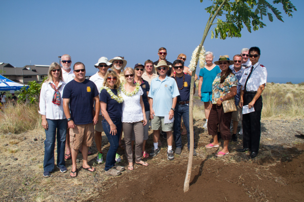
In 2016, PATH’s partnership with the County of Hawaii’s Research & Development Department piloted a bikeshare system in Kailua-Kona to test how bikeshare could work on Hawai’i Island, which was eventually expanded to the Hilo area. As part of this expansion, Mass Transit came on to start subsidizing the bikeshare operation, incorporating it into the family of services provided by the agency.
“Expanding bikeshare and having more stations in the Hilo and Kailua-Kona areas, and potentially in Pahoa and Waimea, is another goal,” says John Andoh, pointing out that it’s vital to promote safe bike riding in those areas. Bikeshare stations with parking lots for those who want to park and ride is also on the table.
Since bikesharing serves as the first mile and last mile connection for those who need to get to or from the bus, as well as promotes active, healthy transportation and exercise, it’s important to have this bikeshare system as part of Hawai’i County’s multi-mobility or multimodal transportation plan.
Bikeshare stations are also incredibly beneficial in areas where a bus route may not make sense because the destination may be close enough to mainline transit. And establishing bikeshare stations near bus routes to get to and from an off-route location eliminates the need to deviate a mainline transit route.
Another form of mobility management, HIBIKE Bikeshare is one example of a program that will help articulate the Mass Transit Agency’s mission to connect and move people in Kailua-Kona, Hilo, and beyond.
For those who want to go from the Kings Shops or Queens Marketplace to the Hilton after shopping, it would certainly be pleasant to ride a bike back instead of making that hot walk or very short drive… and soon, we may be able to!
“As other communities get further developed, perhaps we can add HIBIKE in Ocean View, Pahoa, and Waikoloa Resorts,” says Mr. Andoh.
Planning Your Trip
While the lifespan of the transit and multimodal transportation master plan is 20 years, the plan’s main elements can be accomplished by 2025 at the latest. In fact, many components of the master plan have already been implemented, making it easier to plan your trip using mass transit on Hawai’i Island every day!
The customer service center is already up and running. Here’s how to connect with the center!
- Call 808-961-8744, option #1
- Hours are Mon – Sun, 7am – 5pm
- Schedules are available online at www.HeleOnBus.org
“Also, once we have our general transit speed specification finalized, it will be possible to use Google Maps, Apple Maps, Bing Maps, or third-party app developers like Transit and Moovit to plan trips.”
We’re also working to add automatic vehicle locator (AVL) services on all of our vehicles, so you can see where vehicles are in real time,” says Mr. Andoh, confirming that this app will also be a game changer for anyone who dreads standing outside, wondering when their bus is going to arrive and why it’s not on time.
“For routes that run less frequently than an hour, you’ll be able to see if your bus is running late using the AVL system,” Mr. Andoh explains. With this knowledge, passengers can use that time to run errands or grab some food, and return to the bus stop minutes before their bus actually arrives. A game changer indeed!
Bringing Big Changes to the Big Island’s Mass Transit System: The Takeaway
“It used to take three hours to go between Hilo and Kona, and now it takes a little over an hour. Just having a bus going over Saddle Rd. is a game changer for so many people!” says PATH’s Jessica Thompson. “We’re already headed in the right direction and we’re just getting started!”
Working toward active transportation multimodal options that are accessible requires an implementation plan, the right partners, and the courage to try something that is fundamentally different from what people are used to.
It takes hard work and community support, but Hawai’i Island is closer than ever to being a community where anyone who has to go anywhere has options to get there in a way that’s affordable, convenient, reliable, safe, and good for the health of people and the planet.
Missed PATH’s virtual talk story with Mr. Andoh? Not to worry!
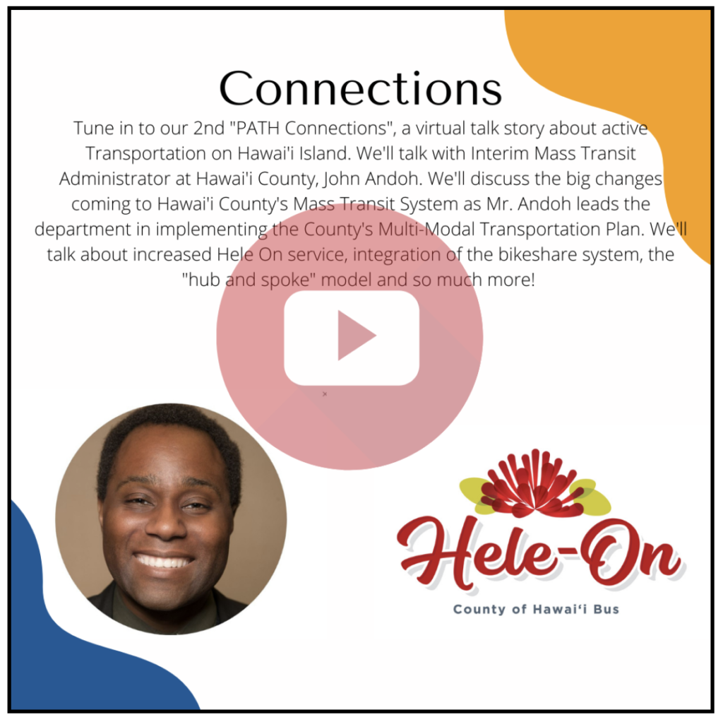
You can watch it here: PATH Connections: John Andoh talks Mass Transit on Hawai’i Island
PATH
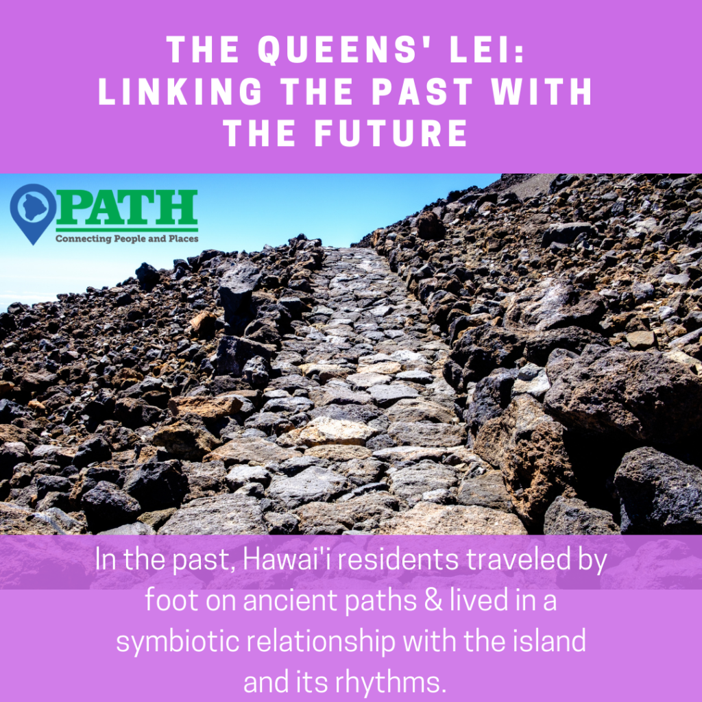
PATH is committed to elevating the efforts of community groups and Hawai’i County to create more multi-modal trails for active transportation in Hawai’i, with an emphasis on developing more protected places for people to use mobility devices, walk, or bike on Hawai’i Island.

 s our Volunteers!